


CATLIN 2 Voting District, Vermilion County, Illinois
About
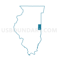
Outline

Summary
| Unique Area Identifier | 575012 |
| Name | CATLIN 2 Voting District |
| County | Vermilion County |
| State | Illinois |
| Area (square miles) | 32.31 |
| Land Area (square miles) | 32.31 |
| Water Area (square miles) | 0.00 |
| % of Land Area | 100.00 |
| % of Water Area | 0.00 |
| Latitude of the Internal Point | 40.04340880 |
| Longtitude of the Internal Point | -87.71693170 |
Maps


Graphs
Select a template below for downloading or customizing gragh for CATLIN 2 Voting District, Vermilion County, Illinois


Neighbors
Neighoring Voting District (by Name) Neighboring Voting District on the Map
- CARROLL Voting District, Vermilion County, IL
- CATLIN 1 Voting District, Vermilion County, IL
- CATLIN 3 Voting District, Vermilion County, IL
- DANVILLE 3 Voting District, Vermilion County, IL
- DANVILLE 5 Voting District, Vermilion County, IL
- DANVILLE 9 Voting District, Vermilion County, IL
- GEORGETOWN 4 Voting District, Vermilion County, IL
- GEORGETOWN 5 Voting District, Vermilion County, IL
- GEORGETOWN 6 Voting District, Vermilion County, IL
- GEORGETOWN 7 Voting District, Vermilion County, IL
- GEORGETOWN 8 Voting District, Vermilion County, IL
- JAMAICA Voting District, Vermilion County, IL
- VANCE 1 Voting District, Vermilion County, IL
Top 10 Neighboring County Subdivision (by Population) Neighboring County Subdivision on the Map
- Danville township, Vermilion County, IL (32,113)
- Georgetown township, Vermilion County, IL (7,901)
- Catlin township, Vermilion County, IL (3,300)
- Vance township, Vermilion County, IL (1,057)
- Carroll township, Vermilion County, IL (612)
- Jamaica township, Vermilion County, IL (202)
Top 10 Neighboring Place (by Population) Neighboring Place on the Map
Top 10 Neighboring Unified School District (by Population) Neighboring Unified School District on the Map
- Danville Community Consolidated School District 118, IL (39,922)
- Westville Community Unit School District 2, IL (7,171)
- Georgetown-Ridge Farm Consolidated Unit School District 4, IL (6,585)
- Catlin Community Unit School District 5, IL (2,963)
- Jamaica Community Unit School District 12, IL (2,409)
Top 10 Neighboring State Legislative District Lower Chamber (by Population) Neighboring State Legislative District Lower Chamber on the Map
Top 10 Neighboring State Legislative District Upper Chamber (by Population) Neighboring State Legislative District Upper Chamber on the Map
Top 10 Neighboring 111th Congressional District (by Population) Neighboring 111th Congressional District on the Map
Top 10 Neighboring Census Tract (by Population) Neighboring Census Tract on the Map
- Census Tract 106, Vermilion County, IL (4,225)
- Census Tract 110, Vermilion County, IL (4,178)
- Census Tract 109, Vermilion County, IL (3,193)
- Census Tract 107.01, Vermilion County, IL (3,186)
- Census Tract 107.02, Vermilion County, IL (3,069)
Top 10 Neighboring 5-Digit ZIP Code Tabulation Area (by Population) Neighboring 5-Digit ZIP Code Tabulation Area on the Map
- 61834, IL (8,454)
- 61846, IL (5,101)
- 61883, IL (4,438)
- 61817, IL (2,583)
- 61833, IL (2,124)
- 61841, IL (1,386)